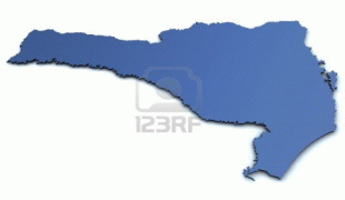
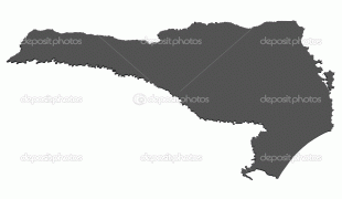
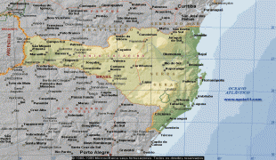
Santa Catarina (Santa Catarina)
 |
 |
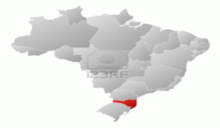
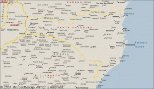
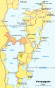
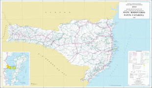
Santa Catarina is bordered by Paraná to the north, Rio Grande do Sul to the south, the Atlantic Ocean to the east, and the Argentine province of Misiones to the west. The coastline is over 450 km, i.e., about half of Portugal's mainland coast. The seat of the state executive, legislative and judiciary powers is the capital Florianópolis. Joinville, however, is the most populous city in the state. Besides Espírito Santo, Santa Catarina is the only state whose capital is not the most populous city. South of the Tropic of Capricorn, situated in the planet's southern temperate zone, the state has a humid subtropical climate (Cfa) in the east and west and an oceanic climate (Cfb) in the center. Climatic conditions vary according to the relief of the region: in the west and mountainous plateau, snow and frost are relatively frequent, while on the coast the climate is warmer, capable of reaching high temperatures in summer.
The territory of Santa Catarina is one of the oldest states in Brazil, separated from São Paulo in 1738, its first governor being José da Silva Pais. The state was created to extend Portuguese domains to southern Brazil until they reached the Rio de la Plata region. It is also the oldest state of the South Region of Brazil, older than Rio Grande do Sul (1807) and Paraná (1853). The state of Santa Catarina was settled by European immigrants: the coast was colonized by the Azorean Portuguese in the 18th century; the Itajaí Valley – a portion of the southern region and northern Santa Catarina – was settled by the Germans in the mid 19th century. The south of the state was populated by the Italians in the last years of the 19th century. Children and grandchildren of Italian and German immigrants who moved from Rio Grande do Sul settled in western Santa Catarina in the mid-20th century.
The state's social indicators are among the best in Brazil. It has the highest rate of life expectancy in the country (just like the Federal District), the lowest infant mortality rate and is also the state with the lowest economic inequality and illiteracy in Brazil. Santa Catarina has the 6th highest GDP in the country, with a diverse and industrialized economy.
Santa Catarina is in a very strategic position in Mercosul, the South American Common Market. Its position in the map is situated between the parallel 25º57'41" and 29º23'55" of the Southern latitude and between the meridians 48º19'37" and 53º50'00" of Western longitude. Florianópolis, its capital, is 1673 km from Brasilia, 705 km from São Paulo, 1144 km from Rio de Janeiro and 1850 km from Buenos Aires.
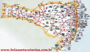
The Serra Geral mountains, a southern extension of the Serra do Mar, run north and south through the state parallel to the Atlantic coast, dividing the state into a narrow coastal plain and a larger plateau region to the west.
The Atlantic coast of Santa Catarina has many beaches, islands, bays, inlets, and lagoons. The humid tropical Serra do Mar coastal forests cover the narrow coastal zone, which is crossed by numerous short streams from the wooded slopes of the Serras.
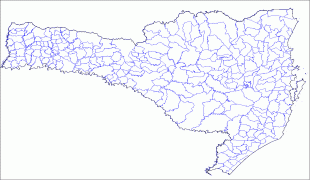
The central part of the state is home to the Araucaria moist forests, dominated by emergent Brazilian pines (Araucaria angustifolia). The drainage of the plateau is westward to the Paraná River, the rivers being tributaries of the Iguaçu which forms its northern boundary, and of the Uruguay River which forms its southern boundary. The semi-deciduous Alto Paraná Atlantic forests occupy the westernmost valleys of the Iguaçu and Uruguay rivers.
The highest point of the state is the Morro da Boa Vista, at an altitude of 1,827 m, and the second-highest point is the Morro da Igreja, in the town of Urubici, at an altitude of 1,822 m.
Santa Catarina is one of the few Brazilian states with a negative deforestation index, meaning that forest coverage grows faster than it is chopped down, thanks to advances in agricultural technology that increase productivity while reducing the space needed.
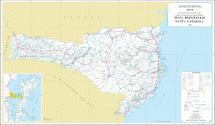
Map - Santa Catarina (Santa Catarina)
Map


Country - Brazil


Currency / Language
| ISO | Currency | Symbol | Significant figures |
|---|---|---|---|
| BRL | Brazilian real | R$ | 2 |
| ISO | Language |
|---|---|
| EN | English language |
| FR | French language |
| PT | Portuguese language |
| ES | Spanish language |


